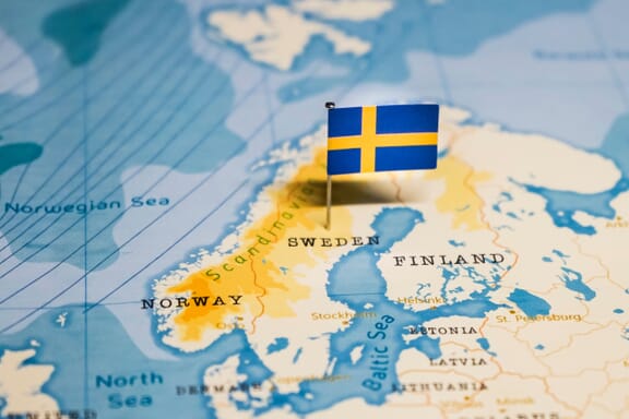
Sweden is located in the Northern Europe region at latitude 60.128161 and longitude 18.643501 and is part of the European continent.
The DMS coordinates for the center of the country are:
- 60° 7' 41.38'' N
- 18° 38' 36.60'' E
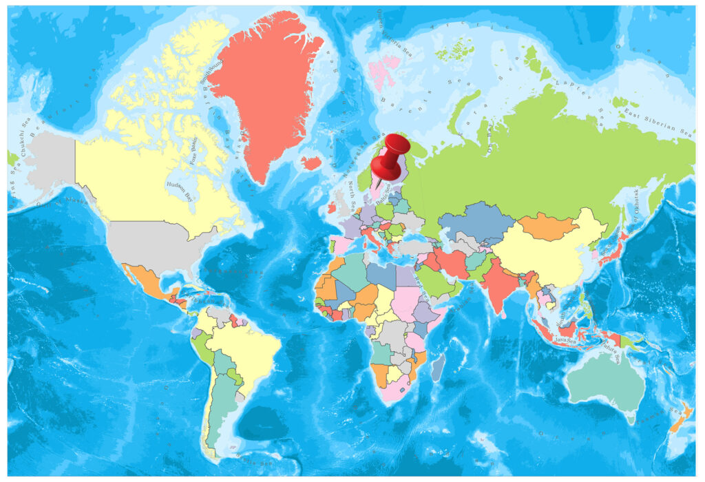
You can see the location of Sweden on the world map below:
Sweden Neighboring Countries
The neighboring countries of Sweden (SE) are:
- Finland (FI)
- Norway (NO)
Maritime Borders
Sweden borders with the Baltic Sea.
Sweden Related Content
Sweden Key Facts
| Country | Sweden |
| Coordinates | Latitude: 60.128161 Longitude: 18.643501 |
| Country Codes | Alpha 2: SE Alpha 3: SWE |
| Country Flag Emoji | 🇸🇪 |
| Int. Phone Prefix | +46 |
| Capital city | Stockholm |
| Continent Subcontinent | Europe Northern Europe |
| Country Area | 450295 sq km |
| Population 2021 | 10,415,811 World Rank: 87 |
| Median Age | 39.5 |
| Life expectancy | 83 |
| Major languages | Swedish (official) |
| UTC/GMT Time | Number of time zones: 1
|
| Internet TLD | .se |
| Biggest Airport | Stockholm-Arlanda Airport (ARN) |
| Average temperature | 10.00 °C 50.00 °F |
| Administrative Divisions | 21 counties |
| Political system | Parliamentary democracy |
Sweden Economy Facts
| World Bank Income Group | High income |
| World Bank Region | Europe & Central Asia |
| Currency | Swedish Krona (SEK) |
| GDP in 2020 | $545.1 (billions of USD) World Rank: 22 |
| GDP per capita in 2020 | $52,300 World Rank: 12 |
| Major Industries / Economic Sectors | Manufacturing, services, agriculture, energy |
| Top 5 Import Countries | Germany, China, United States, Norway, Denmark |
| Top 5 Export Countries | Germany, United States, Netherlands, Norway, Denmark |
Biggest Cities in Sweden
Here are the largest cities in Sweden based on 2021 data:
| City | Population |
|---|
| Stockholm | 975,819 | Gothenburg | 604,829 | Malmo | 269,349 | Uppsala | 165,456 | Uppsala | 133,117 | Vasteras | 128,534 | Orebro | 126,009 | Linkoping | 115,672 | Helsingborg | 113,816 | Umea | 90,412 |
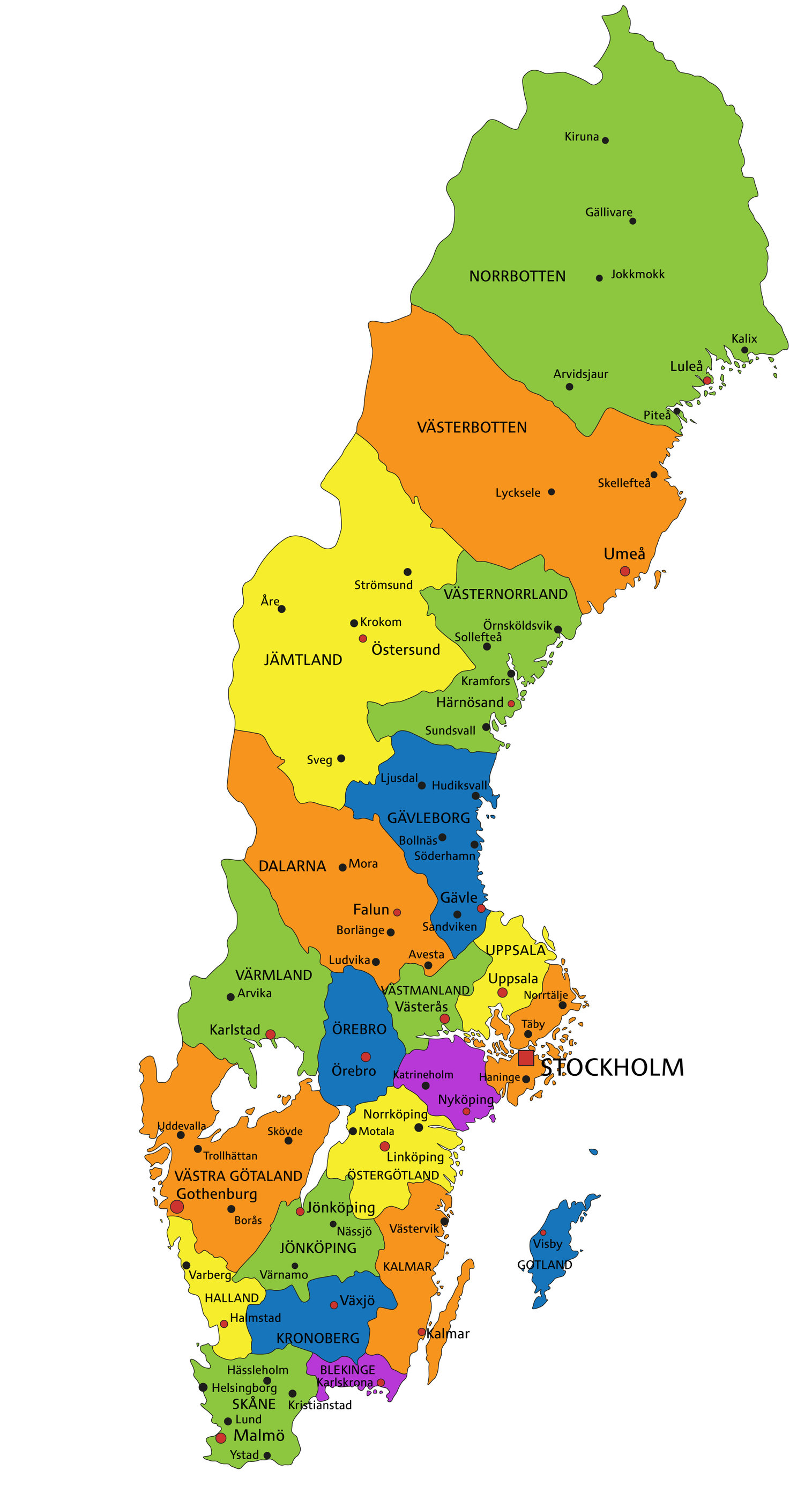
Map of Sweden with the Largest Cities
Other Countries in the Northern Europe Region
Sweden on the World Map
Sweden forms the eastern side of the Scandinavian Peninsula and has quite long coasts.
Political Map of Sweden
Geography
- Population: 10,024,624
- Population Density: 24 per Km2
- Land Area: 410,340 Km ²
The country covers almost 5/8 of the Scandinavian peninsula. There are rivers and lakes that cover the Scandinavian peninsula, and the northern part of the country lies in the interior of the pole circle. In Sweden, there are 96,000 lakes in total, although they are small in size.
The northern part of the green country is mountainous, and the Kjölen Mountains is very popular. Among the main known rivers of Sweden; Iskelette, Torne, Kalij, Lule, Pite, Indals, Dal, Klar are situated and the edges of the rivers have unique natural beauties. Vanern Lake is the largest lake in the country.
Governance
Sweden is governed by a Constitutional Monarchy. The king has limited authority. The executive authority is used when the ministers are established. There is an election for parliament members in every three years. There are 278 municipalities as local authorities in Sweden. Also, there are 21 counties above the municipalities.
Climate
The climate of Sweden is very hard and the climate in the country comes up with two different characters. The eastern part is under the influence of the cold winds, and while the summer is short in the region, the winter season continues quite long. The average annual temperature in the south is 7 degrees, and the average annual temperature in the north is 3 degrees. The average annual rainfall in the north is 400 millimeters, and the average rainfall in the south is 600 millimeters.
Religion
Common religion is Christianity. 89% of the population has a connection with the Swedish Church. In the year 1000, King Olof Skötkonung, who accepted Christianity, played an important role in the spread of Christianity. Furthermore, the Luther Church in central Uppsala has 13 bishops and 2,575 spiritual regions. There are also 35 thousand Orthodox and 15 thousand Jews.
Industry and Tourism
The currency of this country is the Swedish Krona.
Agriculture: Skane ovals in the south are rich in agriculture. Convergent areas make up only 7.2% of the area. Agricultural fields are the front line of production of root crops due to its proximity to the northern latitude of 60, with short grain crops, wheat, barley, oats, sugar beet, potatoes, oilseeds, animal feed.
Livestock: Cattle, sheep, pigs, poultry, milk, butter, cheese, basic animal assets, and animal products. There are also fox and mink farms raised for the post. Annual fish production (a large amount of herring, cod) 200 thousand freezes.
Industry: Sweden has the advantage of its rich natural resources; iron, steel, metallurgy, aluminum, refined copper and lead, paper, all kinds of machinery, automotive, shipbuilding and aircraft construction, electrical and electronic industries are competitive in international markets. Moreover, cement, building materials, weaving, timber, chemistry, medicine, fur, food are other important industrial branches. Stockholm, Malmö, Göteborg, Norköping, Linköping, Vasteras, Uppsala are the major industrial centers.
Natural Resources: Rich mines are extracted from the lowlands of both southern and northern springs. Another important natural resource is forests that cover 50% of the country’s surface area.
Sports
Thanks to great government support to sports organizations (föreningsstöd), sporting events are a national movement in which about half of the population actively participate. Two of the most watched sports are football and ice hockey, and the most important ice hockey players include Mats Sundin, Peter Forsberg, Henrik Lundqvist, Markus Näslund, Daniel Sedin, Henrik Sedin, Daniel Alfredsson, Henrik Zetterberg, and Nicklas Lidström.
Image Sources and Copyright Information
- Swedish Flag Pin on Map: © hyotographics/Shutterstock